Informal Settlements
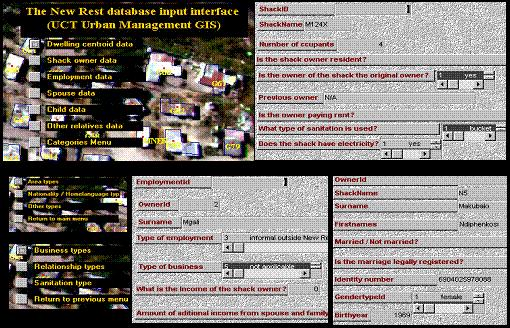
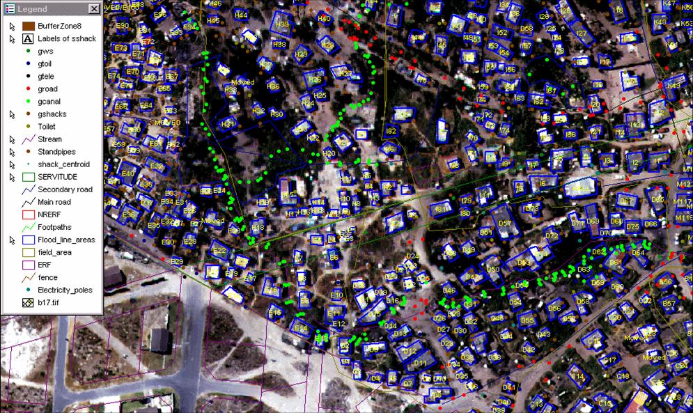
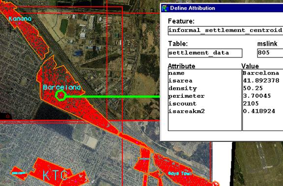
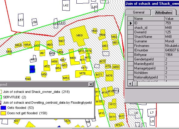
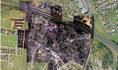
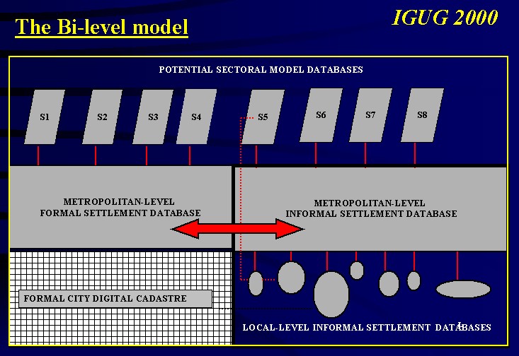
Informal settlement upgradingIn the area of informal settlement upgrading I worked with aerial imagery to map informal settlements in Cape Town (South Africa) at both a metropolitan-scale and on a single informal settlement scale. I also worked extensively with Metropolitan-level vector data, municipal cadastral data and low altitude helicopter imagery. Thematic mapping was a key tool used for local-level informal settlement land use planning and enabled an integrated upgrading approach that incorporated socio-economic, physical and environmental factors. At a metropolitan-scale informal settlement data was captured for several years from aerial photography and formed the basis for simple settlement density and growth rate calculations. This work was carried out using the MGE Intergraph and Geomedia GIS environments for the Urban Management GIS Research Group at UCT. (Please refer to the list of publications for further information on the Bi-level GIS database modelthat was developed and tested for informal settlement upgrading in the Cape Town Metropolitan Region.) Shown below are examples of a Local-level informal settlement database, Helicopter imagery overlying aerial photography, the use of GIS for planning drainage and attribute data for informal settlements. |
|||||||||||||||||||
Click on images to view higher resolution versions where available. |
Acknowledgements  The photographs of the child and the alley in the banner at the top of this page are © by Richard Exely The remaining images were derived from work carried out for the Urban Management GIS group at the University of Cape Town (UCT). 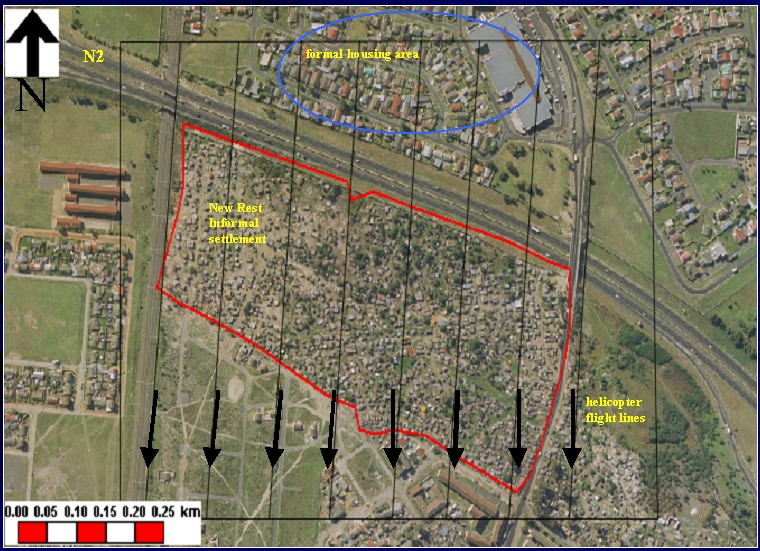 |
||||||||||||||||||